To begin, please read this entire page, as it will provide the necessary background information to understand and successfully navigate this website. If you have already read this page and understand the intended navigation, you may go directly to the online module or browse the additional information provided on the pages linked at the bottom of this page.
Scenario Intent:
This exercise is intended to provide a virtual scenario which requires students to use critical thinking to make natural resource related decisions. There are no right or wrong answers, but the student must be able to support his/her decisions with written and verbal arguments. In fact, the actual outcome is not as important as being able to logically defend the students' provided values and ratings given within the module. Since different people have different values and thought processes, the module output will differ between students.
Background Pages:
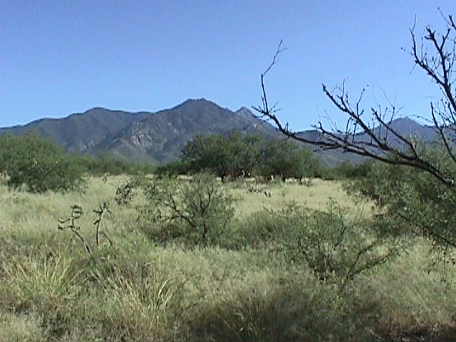
At the bottom of this page, you will find a series of links. The "Panorama" link provides visual information of the current state of the Santa Rita Experimental Range. This is important since most students will not have the opportunity to see the area in question considering two of the module categories require visual quality ratings. To view the 360 degree panoramas, you must install Live Picture Viewer (download available on "Panorama" page). If there are problems installing Live Picture Viewer, or if installation is prohibited on the machine being used, the flat jpg images are also provided. This page will also contain selected images from throughout the SRER.
The "Explanation" link provides a description of how the module was created. This will include an explanation of how the Single Use portion of the module was designed, what calculations were made, how the professional ratings were acquired, and how the multiple use evaluation was completed. It is important to understand how the module works in order to analyze the accuracy of module outputs and to identify any assumptions that may need addressed. The student may find and use weaknesses/strengths in module design to help support their decisions. Remember, there are no set rules or limitations to the student's analysis; just think.
The "Additional Resources" link will be continually changing as the SRER project progresses. This page will contain links to various on-line resources that might provide useful background information to assist in making the value and rating decisions in the module. In addition, students may be directed to certain links to enhance class discussions or assignments. Regardless, these links should be browsed as a starting point for gathering information before further internet and/or library searches are attempted.
At the bottom of each of the above pages, there are links to the other pages within the site. This will allow free navigation between the pages contained within this website.
The Module:
Below are instructions on how to work the module.
- The first task is to register. Just click on the register button and fill out the requested information including a password that you will remember.
- Then return to the login page and type your student identification number and password.
- Then click on "login". This step is important so that your most recently submitted values and ratings can be saved (upon next login, your previously submitted values/ratings will remain the same). This save feature is not available when logged in as "guest".
- Once logged in, you have the option of selecting "single use" or "multiple use". These two options differ in how the SRER land will be used. For single use, you will fill out a table of relative impacts of various land uses and place a value on the different resource attributes.
- A simple calculation is performed (by the computer) and a particular land use is proposed as being the "best" based on how you filled out the single use table.
- For multiple use, a similar table is filled out and combined with actual data from the SRER. The combination of this information is used to determine appropriate land uses on a spatial scale (i.e. grazing, in good grazing areas, campgrounds near sites of attraction, and/or houses in low impact areas.
- Click on the single use
and multiple use links for more detailed
instructions.