Using geospatial technologies to understand dryland dynamics
![]() No.
51, May/June 2002
No.
51, May/June 2002
Using geospatial technologies to understand dryland
dynamics
|
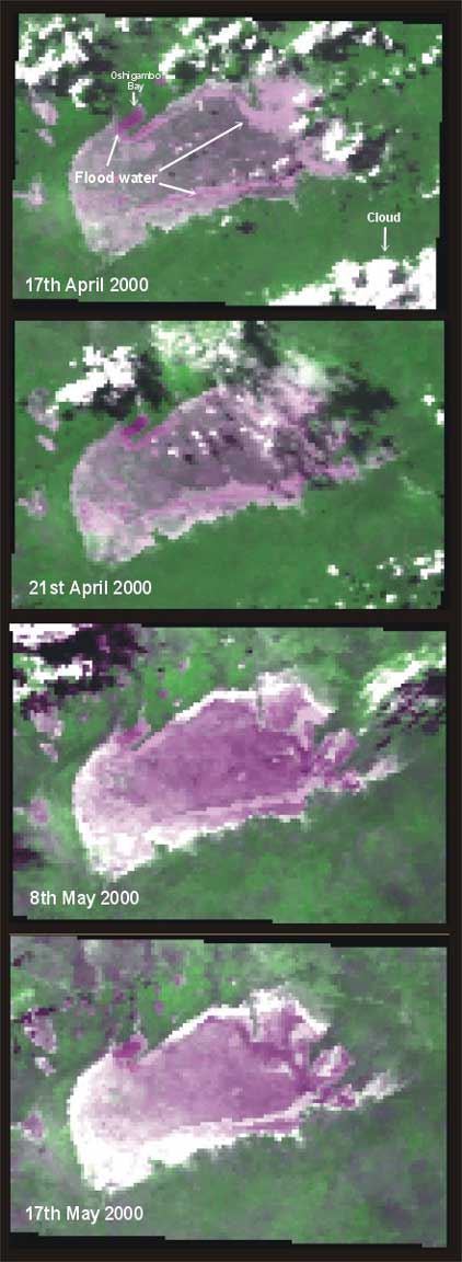
These four AVHRR color-composite images show the flooding on Etosha Pan in 2000. Images for 17th and 21st of April clearly show flood waters entering the Etosha Pan via Osigombo Bay. However these images also demonstrate the problems of cloud interference. Images for the 8th and 17th of May are cloud-free, but show that the flood waters have largely disappeared. Flooding on Etosha Pan is generally short lived and largely restricted to the eastern end of the pan. |
 |