ALN logo; link to Arid Lands Newsletter Home page 
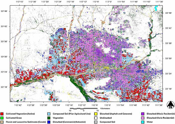
No. 51, May/June 2002
Using geospatial technologies to understand dryland dynamics

Stefanov Figure 1: Land cover classifications, CAP LTER program

map image showing different land cover classifications in Phoenix, Arizona area

[Back to the article text]

Link to ALN home page Link to index page for back web issues Link to index page for pre-web issue archive Link to ALN #51 table of contents