Special issue: Selected papers from the IALC Conference:
Assessing Capabilities of Soil and Water Resources in Drylands:
The Role of Information Retrieval and Dissemination Technologies

Special issue: Selected papers from the IALC Conference: Assessing Capabilities of Soil and Water Resources in Drylands: The Role of Information Retrieval and Dissemination Technologies |
|
| Location of the Walnut Gulch watershed study area, in the semidesert grasslands and shrublands of southeastern Arizona. | 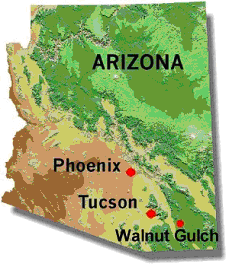 |