Using geospatial technologies to develop
participatory tools for natural resources management
![]() No. 53, May/June 2003
No. 53, May/June 2003
Using geospatial technologies to develop
participatory tools for natural resources management
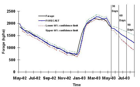 source: GL-CSRP Livestock Early Warning System (LEWS) |
LEWS system users receive a continuous stream of data indicating current forage conditions, forage conditions on the same date last year and the forecasted outcomes in the next 90 days. |