
|
|
|
MEMP Homepage |
The Clark University Component of the University of Arizona / Clark University Cooperative AgreementJ. Ronald Eastman, Mathilde Snel and Nicholas Haan
|
Clark began its activities in Malawi in 1994 with partial funding from ASAP1 to provide assistance to the Malawi Environmental Monitoring Programme (MEMP) in the use of GIS and Remote Sensing technologies and additional funding from USAID-Washington to investigate the issue of sustainable technology transfer in the area of GIS. However, in June of 1994, Clark proposed that these efforts be directed more specifically to the development of a national-level Environmental Information System in Malawi -- a role that was given more concrete definition under a subsequent round of funding under SO2, beginning in 1996. Throughout this period, Clark has worked closely with our partner institution, the University of Arizona, initially under the SARSA cooperative agreement between Clark and USAID, and then with SO2, under a new cooperative agreement between USAID and the University of Arizona/Clark.
Throughout its activity in Malawi, the primary objective has been capacity building in support of the development of a functional national-level Environmental Information System (EIS). Clark recognizes that its efforts in Malawi are in a developmental context, and thus consciously implements its activities with an approach consistent with international development conventional wisdom. Throughout this report collaborative efforts are described. However, the meaning of "collaborative" can be ambiguous. To situate our activities, we envision the following specturm of collaboration:
Sustainable Foundation Building---------Collaborative Jump Start Activities---------Direct Provision
To reach our goal of capacity building towards the development of a national EIS, whenever possible our activities are targeted towards sustainable foundation building which does not always have direct, tangible results; but values long-term sustainability and Malawian ownership over the developmental process. However, some of our efforts are jump start (or demonstration) activities in close collaboration with Malawian partners. The results of these activities are direct and tangible, potentially leading to sustained activities, but lack exclusive ownership by Malawians. Direct provision which has minimal Malawian involvement is avoided whenever possible.
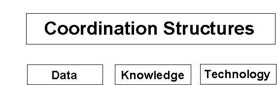
An EIS can be defined as a coordinated set of procedures and institutional structures for the collection, analysis and utilization of environmental information for the sustainable management of natural resources. The primary components of an EIS are diagrammed below. Two of these are readily associated with an EIS -- data and technology. By implication, an important aspect of these is the availability of digital map data and remotely sensed imagery, the technology to develop and process it, and the analytical software that can use it for environmental modeling. The third and fourth components, however, are often poorly accommodated in technology transfer efforts -- knowledge and coordination structures.
 |
Nominally, knowledge is concerned with the ability to use a variety of hardware and software products to process digital data, most particularly in the realm of GIS, GPS (Global Positioning Systems) and Image Processing. However, a particular stress of the Clark programme has been to develop knowledge of the analytical procedures to be used in the context of particular environmental information needs (e.g., the classification of remotely sensed imagery, multi-criteria and multi-objective decision making, soil erosion modeling, land cover change analysis, etc.).
Finally, coordination structures concerns the manner in which participants in the information system are linked to provide effective flows of information into the decision making framework, thus ensuring continued availability of the human, financial and data resources that the system depends upon. According to arrangements that were established under the original MEMP workplan, Clark has worked with the following departments:
In addition, as a result of changes implemented during the second phase of funding under NATURE, UNIMA staff from Chancellor, Bunda and Polytechnic have also been closely involved with the project.
In the following sections, details of Clark inputs to the EIS development as well as efforts at building coordination structures are presented:
Over the life of the product, Clark has worked with Malawian counterparts from each of the participating agencies to develop or access a variety of key data sets using GIS and Remote Sensing technology. These include:
Perhaps the most visible component of the Clark program has been its training programmes. These include:
Training in Geographic Analysis using GIS, Remote Sensing and GPS
Over the life of the project, Clark has trained some 70 government officials and university faculty in the use of GIS, Image Processing (for remotely sensed imagery) and GPS. The primary vehicle for this has been four separate cycles of three training courses: Introductory, Intermediate and Advanced. The primary vehicle for these training has been the use of the IDRISI system -- a GIS and Image Processing system that operates under Windows. Topics covered include:
Introductory
Introduction to GIS
Database Query
Mathematical, Distance and Context Operators
Environmental Modeling using GIS (e.g., Suitability Mapping, Corridor Analysis)
Introduction to Remote Sensing
Supervised and Unsupervised Classification of Remotely Sensed Imagery
System Implementation I
Intermediate
Database development
Multi-Criteria and Multi-Objective Decision Making
Environmental Change Analysis
Advanced
Geodesy and Georeferencing
Map Projections and Spatial Error Analysis
Attribute Error Propagation and Uncertainty Management
Time Series Analysis
System Implementation II
Training of trainers in Environmental Information technologies
The Clark team has felt strongly about making itself obsolete. As a consequence, a special effort has been made during the most recent phase of funding to train faculty from Chancellor, Bunda and Polytechnic in how to conduct these GIS and Remote Sensing trainings. This has included the development of lecture materials, presentation aids, tutorial exercises and data sets, and the conduct of mock lectures. The first results of this process occurred in December 1997 when the most recent Introductory training was conducted (about 85%) by UNIMA staff.
Specialty training in map digitizing
Two courses and a series of follow-up sessions have been conducted in map digitizing using Arc/Info (DAK). The first course was conducted specifically with the Department of Surveys, while the second was conducted with participants from each of the departments.
Specialty training in Soft-Copy Photogrammetry
One specialty course and follow-up sessions were conducted with the Department of Surveys on the use of Soft-Copy Photogrammetry software (DMS) for the digitizing of data from aerial photographs.
Specialty training in Vector GIS (Arc/Info and ArcView)
A long course specifically oriented to the use of Arc/Info and ArcView was conducted with Surveys to facilitate their development of digital map data to be used by all MEMP participants.
Specialty training in Ground Truthing procedures
Two smaller field sessions were conducted with participants from Lands and Forestry in ground truthing procedures for the development and accuracy assessment of land cover maps developed from remotely sensed data.
Specialty training in Rapid Rural Assessment / Participatory Rural Assessment
One field session has been conducted in the use of Rapid Rural Appraisal (RRA) and Participatory Rural Appraisal (PRA) procedures for accessing information at the community level. A second one is planned for March/April of 1998.
Agency Specific Project Assistance
In addition to training sessions, special emphasis was placed in the development of agency-specific pilot projects within each of the agencies for the purpose of cementing the procedures learned during the trainings. In each case, emphasis was placed on the development of pilot projects that were of specific use to that agency, without necessary reference to the larger needs of the MEMP project. It was assumed that these projects could serve a discussion points within their agencies on the value and future development of GIS and related environmental technologies. These projects have included:
- Forestry
Forest inventory / reserve monitoring / change analysis
- Lands
Estate mapping / land cover mapping / change analysis / soil erosion modeling
- Meteorology
Rainfall surface mapping using interpolation from station data
Rainfall surface mapping from Cold Cloud Duration (CCD) data
El Nino monitoring and prediction
- Surveys
Map Digitizing / Soft-Copy Photogrammetry / Data integration from SOS
Digital Data Standard development / Digital map production
A special note should be included here about the large number of individuals trained as part of the Clark programme. It was our strong feeling at the outset that we would lose large numbers of individuals through lateral and vertical promotion and disease (particularly AIDS). By training a large group within each agency, our intention was to provide a strong base for these technologies that could be resistant to such disruptions. This has largely come to pass. However, despite these changes, there remains a core of expertise in each of the agencies. In addition, some of the individuals we originally lost to horizontal promotion have since re-entered the group through vertical promotion.
In conjunction with its partner institution, the University of Arizona, Clark has provided to the participating agencies a substantial amount of hardware and software, including:
Provision of GIS computer workstations and specialty hardware
- computers, digitizers, large format printers, CDR writer, plotters and scanners
Provision of GIS software
- IDRISI, Arc/Info, ArcView, DMS
Provision of Image Processing Software
- IDRISI, DMS
Provision of Office Automation Software
- Microsoft Word, Excel, Powerpoint, PKZIP, Laplink
Provision of GPS hardware and processing software
- Trimble
The development of coordination structures has proven to be the most challenging aspect of the Clark programme. Under the original MEMP workplan, it was intended that the Environmental Affairs Department (EAD -- formerly, DREA, DEA and MoREA) would act as the primary coordinating agency of the evolving MEMP programme. Environmental scientists at EAD would act to design research projects, contract with the participating line agencies for the provision of data products, analyze the data and develop suitable reports. However, this has never become a reality, largely for reasons of inadequate staffing within EAD. In addition, EAD has never been an effective mechanism for the input of information from the community level -- a key element in the development of mitigation strategies. We have made specific strides to demonstrate this need through the recent activity of the Clark team in conducting, with Malawian counterparts, Participatory Rural Appraisal sessions in key areas associated with the Shire River investigation. These issues will be addressed further in the final section. However, specific components of Clarks participation in the development of coordination structures include:
UNIMA Curriculum/Training Program Development
This component has already been described. However, it is a critical component is Malawi is to provide a continuing stream of human resources into the EIS. Malawi cannot depend upon expatriates for future training for reasons both of funding and curriculum inconsistencies. While this programme is in its early phases, it is our hope to be able to continue this effort as a major commitment.
Participation on and advising of GOM EIS Design Team
During the early part of the second phase of funding, an EIS committee was established under EAD's (then MoREA) leadership and guidance from the University of Arizona. The intention of this now-defunct group was to provide oversight of the EIS development. Clark participated as a member of the EIS Design team -- a technical assistance group that was intended to advise this body on the technical details of EIS development. However, while an initial plan of action was adopted, and is still in effect today, the EIS committee has not met since January 1997 largely for reasons of a lack of leadership. This is a major concern, and will need to be addressed in future work.
Development of MAGIC
Early in the first phase of funding, Clark strongly urged the development of a professional society for analysts working in the areas of GIS and Remote Sensing. While some initial attempts were made at organization, it did not initially take hold. However, in the past 18 months, a core of dedicated analysts who have participated throughout the Clark programme have banded together to form MAGIC -- the Malawian society of GIS professionals. While still in its early stages (a formal constitution and legal status are targeted for March/April 1998), MAGIC already informally functions, and was instrumental in organizing the logistics for one of the specialty courses in digitizing. Clark acts as advisors to this group -- a body that we envision will have an important role to play in future issues of professional certification as well as providing a venue for cross-sectoral discussion and professional advancement.
Development of Malawi Digital Map Data Standard
One of the key elements in the development of an EIS is the establishment of a set of standards to ensure comparability and interoperability of digital data sets (most particularly map and image data). Clark has worked closely with the Department of Surveys over the past year to develop a Digital Map Data Standard that covers the key issues of:
- georeferencing standards
- spatial and attribute accuracy reporting
- spatial data transfer formats
- spatial data documentation (metadata)
The Department of Surveys is currently reviewing this document for adoption as a departmental standard. This is a critical issue for Surveys, since the data they provide are not only a service, but also a statement of data quality. This has been an involved process that will ultimately lead to one of the strongest digital data standards in Africa.
While at present the Digital Map Data Standard is intended as a standard for internal use by Surveys, it is the intention of that department to host a workshop for other branches of government involved in the production of map data for revision and adoption as a national standard.
Development of a National Mapping Programme
As might be implied from the above, it is the Clark position that the development of a National Mapping Programme is a critical element of the development of an EIS. What is envisioned here is the coordinated development of digital map data from agencies such as Lands, Forestry and Surveys that can be used together in cross-sectoral analyses with assurance of inter-operability with respect to formats and data standards. Although this is only one element of an EIS, it is a vital component.
Coordination of Data Archiving and Distribution Issues
A key element of the National Mapping Programme is the proper archiving and distribution of data. While we envision that such archives will remain within the line agencies involved, we also see the need for a centralized facility in which the availability of environmental data can be ascertained. To this end, we have investigated archiving and distribution equipment, and have entered into discussions with the Documentation unit of the Social Science Research Council as a potential home for this information center. The more recent development of a documentation unit within EAD provides an alternate venue which is now being explored.
In the second phase of Clark's work associated with the development of an EIS, a case study project was proposed concerning the evaluation of siltation problems in the Shire River Valley. The intention was that this work would be conducted by a Malawian team of specialists, with technical assistance from Clark and Arizona. However, World Bank funding for this project has only now been approved (a year later than expected), and the Malawian team has yet to be officially named. As a consequence, Clark and Arizona have had great difficulty in getting this project to completion within the time frame of the Arizona/Clark cooperative agreement (which is now in its final months). Despite this, Clark and Arizona have continued to interact with each of the participating agencies in the development of key data sets and technical capability. These include:
- An analysis of monthly time series data of vegetation index images (NDVI) to identify hot spot areas of change within the Shire Valley.
- Development of watershed divisions within the Shire
- Selection of specific case study watershed areas based on the time series analysis
- Participatory Rural Appraisal (PRA) investigations within selected watersheds
- A two-week technical session on land cover change analysis, with specific reference to the Shire River Valley.
- A technical session on soil erosion modeling using the SLEMSA model in a GIS environment.
- Field investigations in identified watersheds for land cover classification and accuracy assessment.
- A special technical session to evaluate changes in soil erosion within the Blantyre and Machinga ADD's as well as the more specific cases of the Lisanjali and Lisungwe watersheds, as well as the upper reaches of the Rivi Rivi watershed.
- A special technical session to draw together individual agency components into a coordinated assessment of the Shire (to be conducted in early April 1998).
While this activity has been frustrated by the lack of funding and development of an official team, we do feel confident that all of the necessary components are in place to complete this activity once these arrangements have been solidified.
Over the life of the project, there have been a number of indications that Clark's technology transfer effort is succeeding. These include:
Clark has been involved in a variety of technology transfer projects, most notably with the United Nations Environment Programme (UNEP) and the United Nations Institute for Training and Research (UNITAR). Despite some strong disappointments in these programmes, we have been strongly encouraged by the results in Malawi. A large part of this probably results from the long commitment that has been possible thorough USAID's funding. Unlike many shorter programmes where the computer equipment ends up in some administrator's office (for prestige) and the digitizing tablet ends up as a coffee station, each of the facilities established under MEMP is still being productively used, not only for digital map development and analysis, but also many routine office tasks.
The large effort in training by Clark staff has now yielded a core of dedicated and capable environmental analysts. This is part due to the shear number of persons trained, while has allowed the best to trickle up through the process. However, it has also happened as a result of mixing university faculty with government professionals in the training courses. This has led to a very exciting dynamic, as well as continuing contact between these individuals as they try to solve specific problems. In addition, it should be noted that the advent of democracy has itself had a strong impact. While early in the process, participants were very passive recipients of information and did not engage in much discussion, the sense of freedom of expression that has arisen in the context of democracy has had a very positive impact on the classroom and technical session dynamic. Discussions amongst participants as we work on environmental analyses is vigorous, promoting a healthy exchange of ideas and experiences. Finally, it should also be noted that the potential for advancement offered by becoming competent environmental scientists has not been lost on these individuals. They see an evolving professional identity and this potential for considerable enhancement of their positions by becoming involved in this activity. The indigenous rebirth of MAGIC is a strong testament to this.
There is now starting an indigenous demand for analyses and digital map products. Some examples of these include:
- At the request of the City of Blantyre, Surveys produced a mapping of all building footprints within the city through direct digital photogrammetric output, and subsequent map preparation in ArcView. These data were then subsequently used in a study related to Malaria incidence.
- Lever Brothers has proposed to Surveys the digitizing of city block data for a variety of urban areas to help in its marketing analyses.
- In developing maps to resolve international boundary issues with Mozambique and Zambia, Surveys took the initiative to develop these maps in digital form, without any involvement from the Clark team. Clearly, this agency has already reached the point where they find this technology useful and preferable in certain contexts to traditional procedures. Most importantly, they were able to undertake this mapping entirely without assistance.
- Meteorology has independently begun the process of developing rainfall surfaces using Remote Sensing (CCD) and GIS software for production of its dekadal meteorological reports.
- The Ministry of Agriculture has since 1997 been subcontracted by ICRAF (International Center for Research and Agroforestry) to assess changes in tree cover about select enumeration areas nation wide. Aerial photo interpretation of land cover and distance buffers about populated areas have been used to assess tree cover change from 1962 to 1995.
- The Department of Forestry has been involved in the mapping of approximately two hundred village forest areas in Lilongwe. The maps will be used as a planning tool to implement resource use inventories in the village forest areas. The results of the analysis will be used to draft management plans to help conserve resources in the village forest areas.
- The Ministry of Agriculture, Department of Surveys, and Ministry of Irrigation have worked collaboratively to map proposed and existing national irrigation and dam schemes. Furthermore, maps indicating the siltation of irrigation and dams have been created for management purposes.
- The development of the Digital Map Data Standard was an outcome of Clark's discussions with Surveys. However, the decision to adopt it as an official standard was taken purely by themselves. It is testament, in part, to Survey's commitment to convert its map development process to digital form, regardless of the future of the MEMP programme.
- As already indicated, the Malawian society of GIS professionals, MAGIC, has now undergone a completely organic development, with minimal outside assistance. This acts as a strong indicator of the sense of commitment of its participants to their further professional development in this arena.
- While only an initial step, the conduct of the most recent training by UNIMA staff is an impressive demonstration of capability by the faculty involved. More recently, UNIMA has indicated a strong willingness to adopt an Environmental Science curriculum (being developed with University of Arizona assistance) that includes GIS and Remote Sensing components. We look forward with special interest in facilitating this development.
- As part of the most recent phase of MEMP funding, a special grants programme was established for independent researchers (largely from UNIMA) to investigate issues related to environmental development. The majority of proposals received included GIS and/or Remote Sensing components -- an indication that these individuals understand the potential of using these technologies and the competence to complete the work.
Despite all of these achievements, a strong set of challenges remain in the productive development of an EIS, which we expect to form the core of future activities (if funded). As will be evident from the content of these challenges, high-level support from USAID and counterpart Malawian government structures will be needed to resolve these issues.
Need for a more coherent upper-level coordination structure
There is at present no adequate cross-agency upper-level coordinating body for the development of an EIS. The attempt to develop a national EIS committee has not proven to be successful. This most probably has been a casualty of recent changes in the roles of the NCE, the TCE and the more recent creation of a cabinet-level committee on the environment, as well as the very frequent changes to the structure and position of EAD. There is thus, currently, no stable structure for the coordinated development of the EIS. Clearly this will need to resolved if the EIS is to continue productive development.
Need for a strong lead agency in developing environmental studies and interfacing with decision makers
The original intention that EAD would act as the upper-level coordinating body of MEMP and its related development of an EIS has not, as yet, been successful. While this agency has played a strong role in logistical support, it has not developed the staffing required to provide intellectual leadership. Indeed, the problem is even broader since there is no mechanism for interaction with decision makers, and no regularized procedure for accessing and disseminating data at the community level -- a critical component in the development and implementation of mitigation strategies. These issues have been addressed in a separate concept paper developed for and submitted to USAID in March 1998. Thus they will not be repeated here.
Need for the development of long-range funding strategies
Funding of MEMP and related EIS activities is at present largely dependent upon donor funding. While this will likely be the case for some years to come, a long-term funding strategy needs to be developed to provide an effective channel for donor funds and the eventual Malawianization of this activity. Clearly, the development of an effective upper-level structure previously identified is critical in this respect.
Need for the development of civil service structures/degree requirements appropriate for environmental scientists
Malawi still faces the danger of an erosion of its human resources as a result of unrelated opportunities within government, and related opportunities within the private sector. To alleviate this situation it will be necessary to examine civil service structures for a determination of the conditions that will reduce the likelihood of such losses of human resources. In conjunction with this, it would also be appropriate to review the degree and certification requirements for such positions. It is assumed that the Malawian society of professionals in GIS (MAGIC) could be of substantial assistance in this process.
Need for greater involvement of Malawian analysts in the development of research projects
Now that a core of competent analysts exists in Malawi, it is extremely important that research projects include Malawian co-PI's on these projects whenever feasible. Too many projects are still conducted within Malawi by expatriates without substantial Malawian assistance. This should be avoided since these projects will provide valuable experience in developing environmental analysis skills.