Using geospatial technologies to develop
participatory tools for natural resources management
![]() No.
53, May/June 2003
No.
53, May/June 2003
Using geospatial technologies to develop
participatory tools for natural resources management
by Wolfgang Hoeschele
| "This article specifically addresses . . . problems of communications regarding geospatial methods within government agencies in India; however, the points raised apply equally well to other countries." |
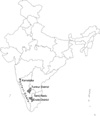
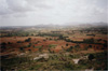
Introduction(Back to top) Wasteland development in India(Back to top) Nowadays, the term wasteland is essentially understood to mean low-quality land from an agricultural point of view, often referred to as degraded land. However, all of the meanings of the term I have just mentioned continue to have some currency, often without recognizing important distinctions. Thus, for example, local village revenue maps as well as the agricultural statistics that are based on these maps continue to define wasteland as uncultivated, non-forested land (which they divide up into cultivable and uncultivable waste), while the categories used for interpreting remote sensing images are based on vegetation cover, soil characteristics, and spatial patterns (e.g., gully formation) (NWDB 1987; NRSA 1991; NRSA and RRSSC 1997). The term "degraded land" is frequently used to refer to desert or high mountain areas, even in the absence of any evidence that these areas have been degraded from some previous better condition. The multiple meanings of the term wasteland can have numerous ramifications within any policy designed to "rehabilitate wastelands," as is a policy goal in India today in the country's effort to increase food security. As may be expected, the term wasteland in India has a special relevance to the country's arid and semi-arid areas. I was alerted to the issue of mapping wastelands in one such area, a small part of the state of Kerala that lies within the rain-shadow of the Western Ghats. Here, a map based on satellite imagery from a single date indicated areas of "permanent fallows" (officially, areas that have remained fallow for at least five years, one type of wasteland), even though those areas are actually being farmed every year during the wet season. A subsequent report consequently recommended various changes in land use, as it did for other "wasteland" areas (not all of which were in fact wastelands) (Hoeschele 2000). A question which I was unable to investigate at the time was what consequences such a classification might have during policy implementation. For example, do government officials put an excessive amount of trust in the maps as compared to the actual ground reality, leading them to assume that lands which are actually being used are unused, and that any land-use change at all would constitute a positive change? It was with such questions in mind that I returned to India in the summer of 2002. Mapping for wasteland development: Issues and challenges |
|
|
I interviewed officials at the national, state and district levels. In this essay, I will concentrate on the state and district levels, where some interesting differences emerged. The states where I chose to conduct my interviews were Tamil Nadu and Karnataka, two southern states with extensive dryland areas classified as wastelands (DLR and NRSA 2000). In the respective state capitals, Bangalore and Chennai, I talked with people at the state-level remote sensing/GIS centers, at the state forest departments (which are also very active in cartography, using remote sensing (RS)/GIS technology), and other relevant state-level agencies. I traveled to the Erode district in Tamil Nadu and the Tumkur district in Karnataka, because both of these had been identified by India's National Remote Sensing Agency as including large amounts of wasteland. In these two districts, I interviewed district-level officials at several different agencies. In Erode in particular the officials were extremely helpful, and also invited me to a planning session including farmers involved in the Germalam project near Satyamangalam. This is a rural development project conducted by an NGO (MYRADA, Mysore Rural Development Agency) in cooperation with district authorities. The information presented here is somewhat preliminary, but I believe points to some of the salient issues that must be considered in using geospatial tools for participatory development. I should add a caveat here that the problems I note may not apply to all projects involving GIS in India, in the states I visited, or even in the agencies where I conducted interviews. The issues I discuss may have been addressed successfully in other projects. That is, based on this research, I can identify certain problems, but cannot indicate how widespread they are. I would also like to note that the officials I interviewed were generally more than willing to answer my questions and to show me around, which I greatly appreciate. Land-use mapping laboratories that have been established in the two states I visited, as in other states across India, use increasingly sophisticated technical methods for their mapping. In both states, projects are underway to overlay data from numerous different information sources available to government into a single GIS document for each district. Data layers include basic topography from Survey of India maps, land cover as determined from satellite data, and soils data from soil surveys. Contour lines are used to derive slope gradients and watersheds are delineated and numbered in a hierarchy that has been standardized for the entire country. Currently, the greatest challenge is to merge data from the above sources with data from village revenue maps. The latter are at a larger scale (generally 1:8000 to 1:10,000 scale) than many of the other available data (often at 1:50,000 scale), though satellite data at larger scales are becoming available. However, village revenue maps have been created through local surveys without being integrated into the larger national grid, thus giving rise to inaccuracies. These have to be corrected by overlaying boundary lines from village maps over satellite imagery, finding the corresponding boundary lines on the imagery, and then rectifying the village maps. Once state-level cartographers have successfully managed to merge these two data sets, they expect to install a system where one can gain access to all the village-level data pertaining to a parcel of land by clicking on the polygon representing that land parcel on the computer. In essence, this would complete the project of integrating all governmental data sources on land use, land quality, and land ownership in one geographical database. Respondents at the state level explained to me that GIS facilities are available primarily at the state level; while increasing numbers of computers are being used at district headquarters as well, these do not include advanced GIS software. At most, district-level officials can use software that allows simple queries to be made from GIS databases that have been created elsewhere. I was told that it is simply not possible to make such software available down to the district level, both as pertains to the cost of equipment and to the training of district-level staff. I also discussed the possibility of obtaining information from land users, for example about land quality, and adding this data into the GIS, but it did not appear that anybody had thought of this. Thus, the dominant model clearly is that knowledge is generated at the state level and then disseminated to the local level. Technological requirements appear as an obstacle to this dissemination, rather than as offering new potentials (such as the potential for incorporating different kinds of data input or for making more dynamic maps available to local users; see for example Robbins 2001;, Bojorquez-Tapia et al. 2001). At the district level, my enquiries focused primarily on mapping projects which had already been completed, rather than on those in progress -- i.e., how were those maps being used? It turned out to be difficult to determine where the maps had gone. I was particularly interested in a series of wasteland maps at 1:50,000 scale. Wastelands, divided into thirteen categories, have been mapped at this scale for the entire nation, based on satellite imagery. Copies of these maps were sent to all of the districts, I was told in the state capitals. In Erode, nobody knew about them, though several respondents were familiar with a different map series, prepared by the Department of Agricultural Engineering, which specified sites where conservation structures were to be built. These latter maps are used frequently, in order to monitor which structures have actually been constructed. The officials I met clearly did everything in their power to help me, and therefore I believe that the wasteland maps had truly been forgotten. I asked about what they do if they receive funds for wasteland development: how do they decide where to use that money? As one horticultural officer explained to me, they know the land, they don't need maps from the state for that, and if they do use maps, they use the village revenue maps. I suggested that these do not provide indications about the quality of the land; he responded that the officials are familiar with land quality in different areas and can in any case ascertain actual conditions through local inspection. Such responses clearly indicate that the district-level officials prefer the information sources they themselves control, i.e., the village revenue maps. In fact, some of my respondents questioned the utility of any land use maps coming from the state. Focus on Erode district |
|
|
(Back to top) |
|
|
Theoretically, it should be possible to integrate this mapped information with information from central and state mapping agencies. I therefore asked Mr. Amarnath Jadav, who runs this MYRADA project, whether remote sensing data could at all be useful in their efforts. He seemed very skeptical, particularly because those data are considered classified in this particular area. A forest brigand named Veerappan is sometimes active here (as in much of the boundary region between Tamil Nadu and Karnataka), and the Tamil Nadu police therefore restrict access to maps. Although Jadav as well as Mr. Jeganathan, the officer from the Agricultural Engineering Department, who had brought me here, did not consider these restrictions very useful (Veerappan knows his way around the forest perfectly well without maps), they considered it unrealistic to expect that the restrictions might ever be lifted. However, they have produced some maps on AutoCAD, using enlarged Survey of India topographical maps as a base complete with contour lines, with superimposed information from the sketch maps made in the villages. This would provide a base to which remotely sensed imagery or soil survey maps and the like could be added. Note also that Mohan (2000) reports about the use of remote sensing imagery in a part of Gulbarga district (Karnataka) where Marxist rebels are active; security concerns there do not seem to prevent the sharing of cartographic information with MYRADA and local land users. Ironically, then, it seems that in Erode, the greatest problems of communication occurred, not between the local government and the local people or the NGO, but between the state government and the local government. The observed communication problems result at least in part from the model of knowledge that is applied. In the case of the sketch maps, data input and interpretation are accomplished by the people with local knowledge, and are therefore in their control. In the case of remote sensing and GIS, however, both data input and interpretation are in the hands of centralized agencies. Some preliminary conclusions(Back to top) A useful model to follow in this context is provided by Dalal-Clayton and Dent (2001): a series of questions includes what the information is going to be used for, who will use the data, whether relevant data already exist, what useful information is held by the community, who can provide the data, whether proposed survey methods are appropriate, and what support there is for the project. Their book discusses each of these questions at length and presents field-tested methods of approaching them, illustrated by case studies. This kind of questioning broadens the scope of what is considered "data" and who can supply and interpret the data. The technical challenges in such an effort may indeed be less than the sociological ones, since the model of knowledge emanating from the state and national level downward is quite pervasive (see for example Springer 2000). Any project involving geospatial technologies for participatory development should therefore emphasize that knowledge can and must flow from the local level to higher levels within as well as outside of the bureaucratic hierarchy. References(Back to top) Dalal-Clayton, Barry, and David Dent. 2001. Knowledge of the land: Land resources information and its use in rural development. Oxford: Oxford University Press. Department of Land Resources (DLR) and National Remote Sensing Agency (NRSA). 2000. Wastelands atlas of India. New Delhi: Government of India. Hoeschele, Wolfgang. 2000. Geographic information engineering and social ground truth in Attappadi, Kerala State, India. Annals of the Association of American Geographers 90(2): 293-321. Mohan, Kapil. 2000. India (1). In Proceedings of multi-country study mission on integrated local community development to the Republic of China, 184-196. Tokyo: Asian Productivity Organization. Online: http://www.apo-tokyo.org/icd/papers/E-Publications/02.IntegLocCommDev/03-04.pdf (accessed 7 July 2003). National Remote Sensing Agency (NRSA). 1991. Guidelines to use wasteland maps. Hyderabad: NRSA, Government of India. NRSA and Regional Remote Sensing Service Centre (RRSSC). 1997. Manual of procedure for preparation of wastelands digital data base using remote sensing and GIS techniques. Hyderabad: Department of Space, Government of India. National Wasteland Development Board (NWDB). 1987. Description, classification, identification and mapping of wastelands. New Delhi: Ministry of Environment and Forests, Government of India. Poffenberger, Mark, and Betsy McGean. 1996. Village voices, forest choices: Joint Forest Management in India. Delhi: Oxford University Press. Robbins, Paul. 2001. Fixed categories in a portable landscape: The causes and consequences of land-cover categorization. Environment and Planning A 33: 161-179. Springer, Jenny. 2000. State power and agricultural transformation in Tamil Nadu. In Agrarian environments: Resources, representations, and rule in India, eds. A. Agrawal and K. Sivaramakrishnan, 86-106. Durham, North Carolina: Duke University Press. |
![]()
(Back to top)
Dr. Wolfgang Hoeschele is a geographer in the Social Science Division at Truman
State University, Kirksville, Missouri. He can be reached for comment at:
whoesch@truman.edu.
(Back to top)
MYRADA
http://www.myrada.org
Information about MYRADA's mission and beliefs, capacity building activities,
specific projects, publications, and more.
National Remote Sensing Agency, India
http://www.nrsa.gov.in/
Detailed information on NRSA's satellites, products, services, training programs,
and images.
Institute of Remote Sensing, Anna University, Chennai
http://annauniv.edu/irs/index.html
Web site of Tamil Nadu State's remote sensing center.
About the Arid Lands Newsletter