 |
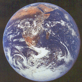
Earth from Apollo 8 This photograph shows the continent of Africa and the Arabian Peninsula. The Sahara, Kalahari, and Arabian deserts (as well as southwestern Madagascar) are clearly visible as brown-colored areas. Clouds cover much of central Africa. The dark band immediately to the south of the Sahara is known as the Sahel, the Arabic word for "shore." When Arab merchants and soldiers arrived in North Africa around 650 a.d., shortly after the Islamicization of Arabia, they became aware that the Sahara's southern boundary advanced and receded like oceanic tides. |
Half the countries on earth lie partly or entirely in the arid and semiarid zones, which cover one-third of the planet's land surface, 44 percent when the subhumid zone is included. In 1950, the population of these countries was 76 million; in 1985, population reached 205 million. The forecast for 2000 is for 300 million people to be living on the Earth's drylands.
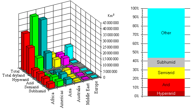
The correct citation
for this chart is:
Milich, L., 1997. Deserts of the world.
http://ag.arizona.edu/~lmilich/desert1.html.
 Select a
desert
Select a
desert
Desert Locator Maps with Climate Classifications
Desert geomorphology
Cryptic LifeThis site last updated October 30, 1998.